King Mountain Hike in Larkspur: Marin County Loop Hikes
The King Mountain Hike in Larkspur is one of the best kept secrets in Marin County. This four-mile well-maintained loop hike in the hills above Larkspur features beautiful bay, mountain, and — on clear days — even city views. Access is fairly easy, and the trail is dog-friendly and shaded after the initial mile or so. The steepest part of the hike is at the beginning during the warm up phase. However if you make it through this, you’re rewarded with beautiful views in all directions (see walkthrough below).
Another plus is after the hike you can easily drive or walk back down to Magnolia Avenue and reward yourself with a pastry and coffee at Emporio Rulli, or if later in the day enjoy wine tasting at Backstage Wines or dinner at Picco. (Check the Larkspur Lifestyle section of my Larkspur Homes for Sale Page for more ideas.)
KING MOUNTAIN HIKE — GETTING THERE
I access the King Mountain Loop Trail via the Citron Fire Road. Parking is usually fairly plentiful along Ward Street in Larkspur, or you can continue and park along Willow Avenue, which intersects with one of the Citron Fire Road trailheads (maps and walkthrough below.) Parking along both streets is parallel parking. If parking in downtown Larkspur, be mindful of parking restrictions and read all signage carefully. Much of the parking closer to the downtown is zoned for 2 hours.
Helpful Tip: While Cedar Avenue does also intersect with the Citron Fire Road, it is a very narrow lane with little or no street parking. I would not suggest driving up Cedar even if your GPS routes you that way.
KING MOUNTAIN HIKE QUICK FACTS
- Gorgeous views: Mt. Tam, Greenbrae, Larkspur, San Rafael, the Bay and even the city on clear days
- Not a well-known hike. Few people, even on weekends.
- Well-signed and easy to follow
- Citron Trail: Dogs on voice command. King Mountain trail: dogs on leash – click here for a list of dog-friendly hiking locations
- Citron Trail: Bikes allowed. King Mountain trail: bikes prohibited.
- See trail rules in photos below
- Excellent cell service
- One bench on trail
- Wheelchair access: challenging
- No drinking fountains or restrooms
- Well-maintained trail. Poison oak is present but not protruding into the trail.
- Long pants recommended due to presence of ticks. Watch dogs especially during coyote mating season.
KING MOUNTAIN HIKE MAP
KING MOUNTAIN HIKE OVERVIEW
Parking along Willow Avenue is fairly easy, but if spaces are full you can keep going, curve left then come back on Sycamore and park farther down. Please be respectful of neighbors — drive slowly, watch for children, and keep voices / radios low. Once parked, you will walk up Willow to the trailhead and turn right. This is a wide dirt roadway that has curbs on the right — at one time this was planned for further development before it was preserved as open space. There’s a gentle incline until you reach the junction of Cedar Avenue (dirt road to the right) and Citron Fire Road to your left. Go left to the Citron Fire Road, enter the second trailhead and begin your ascent.
There are a variety of switchbacks and before long you will see beautiful views of the bay and Larkspur below. When I was walking up, I heard the chimes ringing from St. Patrick’s Church down below. For a moment I thought I was in Europe! Keep walking and you’ll begin going north and meet the junction of the Citron Fire Road and Skylark. Follow the trail to the left up (this is where it becomes really steep) and you will intersect with the King Mountain Loop Trail. Take that to the right, loop through beautiful madrone and redwood trees (nice and shady!) and then come back down to intersect with the Citron Fire Trail which will take you back down to your car.
Please scroll down to see the visual walkthrough below.
KING MOUNTAIN LOOP PHOTO WALKTHROUGH
Pictured above is the trailhead for the Citron Fire Road just off Willow Avenue in Larkspur. This fire road leads to the Ring Mountain Loop Trail above. Note the old curbs on the right — clearly at one time this was slated for a housing development.
Here’s a shot of the Citron Fire Trail just a bit after the trailhead. It is uneven here so watch your step. I actually ended up walking on the curb on the way back down. Enjoy this shade as you will soon be emerging into the sun (but more shade is the reward at the top of the mountain!)
This is the intersection of the Citron Fire Road (left) and Cedar Avenue (to the right). Keep left here and go through the trailhead gates.
Go through the gates and consult the map and any important trail notices just ahead on your right. The incline becomes steeper soon!
Trail Rules – Please Click Above to Enlarge. Note that dogs are allowed to be off-leash on the fire road, but once you take the King Mountain trail you will need to leash them.
This is the last flat part of the trail for a while. Savor the beauty. You can see why they call California “The Golden State!”
This is the first view you will see as you ascend. On a clear day you may see San Francisco…
The incline becomes much steeper now… but the payoff is coming…
A beautiful view of the town of Larkspur and the bay beyond! This is the spot where I heard the bells of St. Patrick’s Church below chiming.
Another trail junction is coming up. Keep left.
Follow the arrow and keep left to intersect with the King Mountain loop trail.
This is the steepest part of the hike. Up ahead you will intersect with the King Mountain loop trail.
You have arrived at the King Mountain Loop Trail! Keep right to begin looping counter-clockwise around the mountain. It becomes shady and the vegetation changes significantly with lots of ferns and other water-loving plants in the forest.
Look up and behold the canopy of California Redwoods. At one time this mountain and surrounding hills were covered with them. Many were chopped down to fuel the re-building of San Francisco after the great fire and earthquake in 1906.
This bridge and small bench are my favorite part of this hike. If you know the story of the bench, please leave a comment at the end of this article.
After a rest on the bench, time to tackle the stairs!
The gate is private property. Turn right (away from gate) then turn left and resume the counter-clockwise hike around the mountain.
The trail sign is missing from this post. Turn left to continue the counter-clockwise loop around King Mountain.
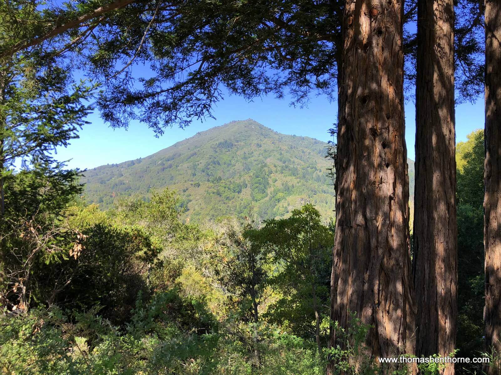
This view is so beautiful I decided to use it as the lead shot for this article. The trail will narrow and you will brush up against grass. Poison oak is just off the trail so you need to be vigilant and watch kids / dogs.
The trail becomes single-track here with beautiful views of Kentfield and Mount Tamalpais.
Follow the sign to stay on the King Mountain Loop Trail.
Another beautiful vista from the trail before you finish the loop. On a clear day, you can see San Francisco.
A view around every turn — Larkspur on the right, Greenbrae on the left, and San Rafael in the distance. You can also see the Richmond-San Rafael Bridge.
A few more steps and you have completed the loop. Then you follow the Citron Fire Road back down to Larkspur and reward yourself with something delicious from Magnolia Avenue!
I hope you have enjoyed reading my article about the King Mountain Loop Hike. If this is your first visit to my Marin Real Estate and Lifestyle Blog, please have a look at my other articles. They all feature original articles about the things that make Marin County such a great place to live — restaurants, hikes, and even profiles of those who live here. Also in my blog is my monthly Marin real estate market update. Should you have any real estate questions or needs, please call or text me at 415.847.5584 and I’ll be in touch right away. Otherwise, I will see you on the trails!


Leave a Comment
What do you think?Please leave your comment below!