Rodeo Beach Hike: Hiking Marin County
The Rodeo Beach hike at Fort Cronkhite in the Marin Headlands has been on my list of Marin County hikes to try for years, and a few weeks ago I found a couple of hours to go with a friend. If you are looking for a hike with stunning views, easy parking, historical significance, and did I mention — stunning views — this is the hike for you!
RODEO BEACH — GETTING THERE
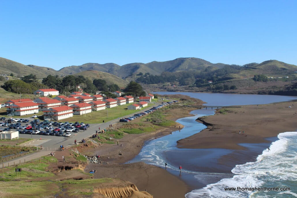
Getting to Rodeo Beach is extremely easy — there are a variety of routes and options. I was surprised to see that even MUNI services the area on Sundays and holidays. You might think the ease of access would make the area very crowded, and a lot of people do visit. However in my visits to Rodeo Beach it never feels crowded. Why? Because the are so many places to explore and there is ample parking. It is also a very bike-friendly area with most trails allowing cyclists and dogs on leash or under voice control. Most visitors either cycle or drive. If you live in Marin, you can drive via the Marin Headlands, or more directly via the Baker-Barry tunnel (“aka the 5-minute-wait tunnel”) which is closed through the middle of 2017 for refurbishment.
However you go, you will end up on Bunker Road from which you can turn onto Mitchell Road, which dead-ends at the Rodeo Beach / Fort Chronkhite parking lot. Street parking (front of car towards the ocean) is also available on the left side of the road. Note: Technically, the entire area is called Fort Conkhite, but the signs feature both names, and most people call the area Rodeo Beach.
Warning: Be sure to lock your vehicle and take valuables with you. In March 2017, a friend’s car was broken into during a busy weekend while parked in the parking lot. If anyone approaches you with a seemingly-innocent question just after parking, be very vigilant as there seems to be an organized group that’s working in this area.
RODEO BEACH HIKE QUICK FACTS
- Plentiful parking along the street as well as in the large lot at the end of Bunker Road
- Dogs allowed on leash on beach and trails
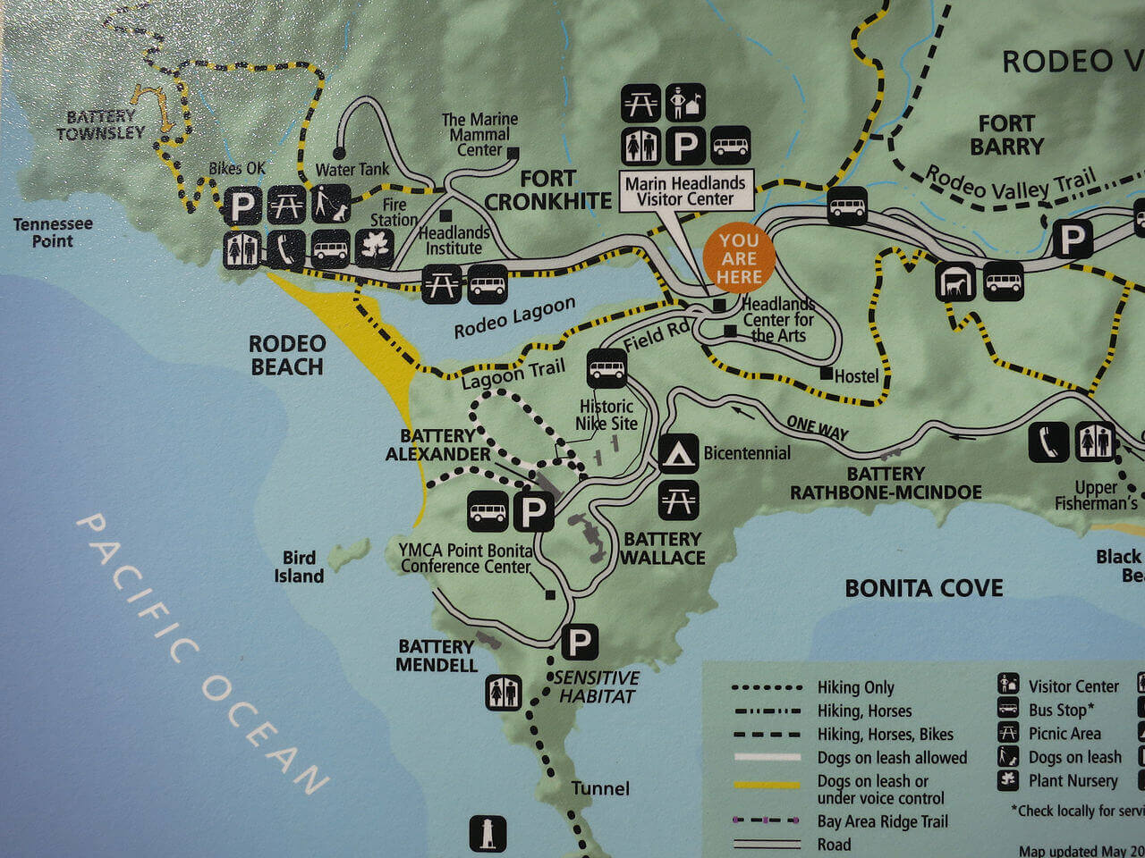
- Bicyclists allowed on most trails (see map below)
- Cell service in most areas (AT&T)
- Historic walking tour available
- Public restrooms (accessible) adjacent to parking lot
- Water fountains / garbage receptacles also available
- Multiple hiking options (see map below)
RODEO BEACH / FORT CRONKHITE HISTORY
The first thing you will notice as you enter the Rodeo Beach parking area is the historic buildings everywhere. The entire area was an off-limits military installation in the last century, and was built as the first line of defense for the San Francisco Bay area and the entire West Coast of the United States. The US Army soldiers stationed here manned the bunkers that are located on the ridges high above Fort Cronkhite.
The entire area is a lot of fun to explore — with every turn there is a beautiful view or an historic artifact. The park service has put together a great history walk. You may want to print it out before you go because signage, while adequate, is minimal.
The fort was decommissioned as a military facility on September 10, 1974. Today Fort Cronkhite is used as office space for the National Park Service as well as a number of non-profit organizations.
Here is a map of the area:
RODEO BEACH HIKE
Once you arrive at Rodeo Beach, you may want to explore the area before beginning your hike. There are maps available at the Marin Headlands Visitors Center. Since there is cell service, I used Google Maps on my iPhone to find my way around. In the map above, the parking lot is in the top left of the illustration. From there, you can walk around Rodeo Lagoon, where bird watching is popular, or take one of the trails that branch out from this location.
I had two goals for our visit that day: exercise and views. My friend, who knows the area well, recommended that we walk up the trail from the parking lot towards Battery Townsley. Incidentally, the site is open to the public the first Sunday of the month from 12-4. Volunteers open the metal doors of the battery and speak to visitors about the rich history of the area.
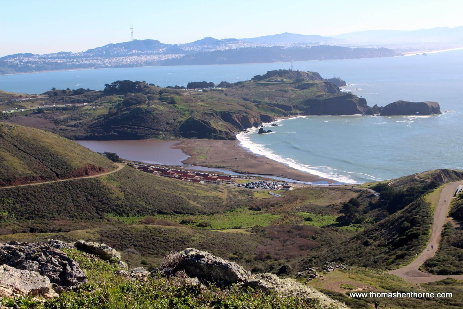
Below is the beginning of the trail, in the bottom right of the photo. You can see the parking lot to the left and then the beach and Fort Cronkhite buildings in the distance:
The trail begins to climb upwards via a series of switchbacks, and before long you are high above the beach…. In several areas there are separate trails for walkers and bicyclists and in other parts of the hike you share a fire road.
THE BATTERY TOWNSLEY
After a beautiful and moderately strenuous hike up the hill in the direction of Tennessee Point, you come across Battery Townsley, an example of gorgeous decay that stands in stark contrast with the beauty around you. We had a great time exploring the battery and hope to return for the monthly tour. Incidentally, we saw a bright orange salamander swimming in the pool (photo below) where one of the enormous guns was originally placed. He was too quick for my camera so keep an eye out for him if you decide to try this hike.
The guns at Battery Townsley were 68 feet long and could fire a 2,100 pound projectile almost twenty-five miles. Never fired in battle, the original guns were scrapped in 1948. The gun below was originally placed in service on the USS Missouri in 1944. Plans call for the gun to be re-mounted in the battery at some point in the future to help illustrate the history of the battery. For now it makes its presence known on the trail!
As the trail continues upwards, the views become more and more spectacular. We stopped on the peak pictured below after about 45 minutes of hiking and snapped this photo of Rodeo Beach and San Francisco in the distance. It was one of those “We are so lucky to live here!” moments. Gorgeous!
Back down at the beach, I snapped this photo. I imagine there was a beautiful sunset that evening but I needed to go show houses and work on an offer.
I took this photo from the passenger of a moving car as my friend drove us home through the Marin Headlands. I am so thankful to live here.
I hope you have enjoyed reading my article about my Rodeo Beach hike. If this is your first visit to my blog, please have a look at my other articles. They all feature original articles about the things that make Marin County such a great place to live. Also in my blog is my popular monthly Marin real estate market update. Should you have any real estate questions or needs, please call or text me at 415.847.5584 and I’ll be in touch right away.
Join the VIP List
Subscribe to my quarterly newsletter to receive the latest news on the Marin real estate market, the best hikes in Marin County, new restaurants and everything that makes living here so special.


I would love to hear your Rodeo Beach tips…. have you tried any of the other trails there?
No but I also like Tennessee Valley and the hikes there.
Watch my blog for an overview of the Tennessee Valley hiking options, coming soon!
Do you know the origin of the name Rodeo Beach? Feel free to email me charlesversaggi@me.com Thanks!
Hi Charles, I do not know the origin of the name but have the question into a ranger friend of mine. I’ll post it here if he knows the name. Thanks!
I asked my park ranger friend and he said: “Couldn’t find anything definitive but the name Rodeo appears in the earliest American surveys and maps. Though no one recorded the name’s exact origin, it apparently comes from Mexican-era cattle roundups & rodeos held in the valley now known as Rodeo Valley…. thus, this is why we in the park service tend to pronounce it “RO-deo” not “ro-DEO.”
Love Rodeo Beach hikes. Always one of my favorite areas to go. The Battery Townsley looks like a great spot.
Judy, glad you enjoy the hikes there…. have you tried any of the other trails?
There is also good cell service there with Verizon.